Elena A. Mikhailova
(Department of Forestry and Environmental Conservation, Clemson University, Clemson, SC 29634, USA)
Lili Lin
(University Key Lab for Geomatics Technology and Optimized Resources Utilization in Fujian Province, Fuzhou 350002, China)
Zhenbang Hao
(University Key Lab for Geomatics Technology and Optimized Resources Utilization in Fujian Province, Fuzhou 350002, China)
Hamdi A. Zurqani
(University of Arkansas Agricultural Experiment Station, Arkansas Forest Resources Center, University of Arkansas at Monticello, Monticello, AR 71655, USA)
Christopher J. Post
(Department of Forestry and Environmental Conservation, Clemson University, Clemson, SC 29634, USA)
Mark A. Schlautman
(Department of Environmental Engineering and Earth Sciences, Clemson University, Anderson, SC 29625, USA)
Gregory C. Post
(Geography Department, Portland State University, Portland, OR 97202, USA)
Laws, MDPI, vol. 11(2), pages 1-19, March
Abstract
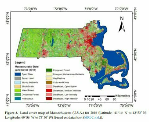
The state of Massachusetts (MA) has passed comprehensive climate change legislation and a roadmap of achieving Net Zero emissions in 2050, which includes the protection of environmental resources (e.g., soil) and green space across the state. Soil resources are an integral part of the land cover/land use. They can be a significant source of greenhouse gas (GHG) emissions because of the conversion of “low disturbance” land covers (e.g., evergreen forest, hay/pasture) to “high disturbance” land covers (e.g., low-, medium-, and high-intensity developed land). These often “invisible” GHG emissions can be considered as “negative externalities” and “external costs” because of the difficulty in assigning ownership to the emissions. The combination of remote sensing and soil information data analysis can identify the ownership associated with GHG emissions and therefore expand the range of policy tools for addressing these emissions. This study demonstrates the rapid assessment of the value of regulating ecosystems services (ES) from soil organic carbon (SOC), soil inorganic carbon (SIC), and total soil carbon (TSC) stocks, based on the concept of the avoided social cost of carbon dioxide (CO 2 ) emissions for MA by soil order and county using remote sensing and information from the State Soil Geographic (STATSGO) and Soil Survey Geographic Database (SSURGO) databases. Classified land cover data for 2001 and 2016 were downloaded from the Multi-Resolution Land Characteristics Consortium (MRLC) website. The results provide accurate and quantitative spatio-temporal information about likely GHG emissions, which can be linked to ownership. The state of MA can use these remote sensing tools and publicly available data to quantify and value GHG emissions based on property ownership, therefore “internalizing” the costs of these emissions for a cost-effective climate mitigation policy.
Keywords: CO2
; climate change; emissions; law; policy; property; social costs; urbanization
-----------------
Elena A. Mikhailova & Lili Lin & Zhenbang Hao & Hamdi A. Zurqani & Christopher J. Post & Mark A. Schlautman & Gregory C. Post, 2022. "Massachusetts Roadmap to Net Zero: Accounting for Ownership of Soil Carbon Regulating Ecosystem Services and Land Conversions," Laws, MDPI, vol. 11(2), pages 1-19, March.


